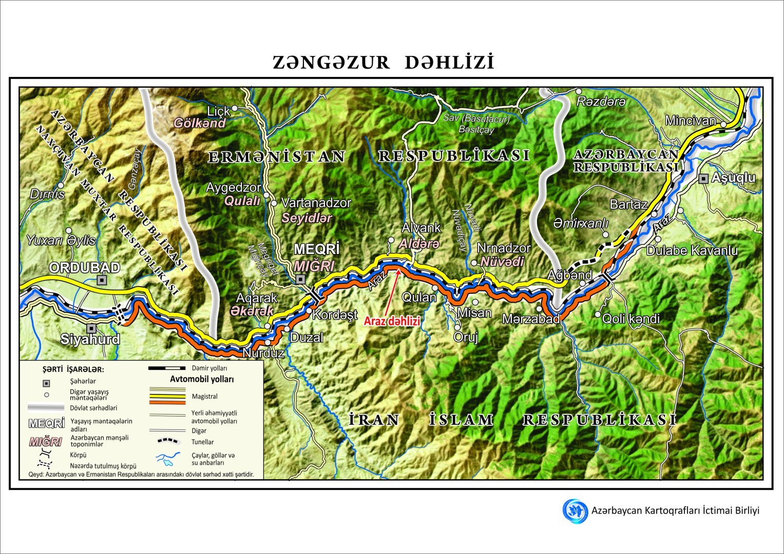
BAKU, Azerbaijan, October 14. The "Azerbaijani Cartographers" Public Union has developed a map of the Zangezur Corridor, said the association’s chairman, Mugabil Bayramov,TurkicWorld reports.
Bayramov articulated that the foundational layer of the cartographic representation was synthesized utilizing high-resolution satellite imagery, thereby guaranteeing an accurate and intricate depiction.
The cartographic representation delineates pertinent geographical segments of Azerbaijan, Armenia, and Iran, encompassing urban settlements, transportation corridors, fluvial systems, and topographical elevations. The schematic representation additionally encompasses the Aras Corridor and is accessible in dual linguistic formats: Azerbaijani and English.