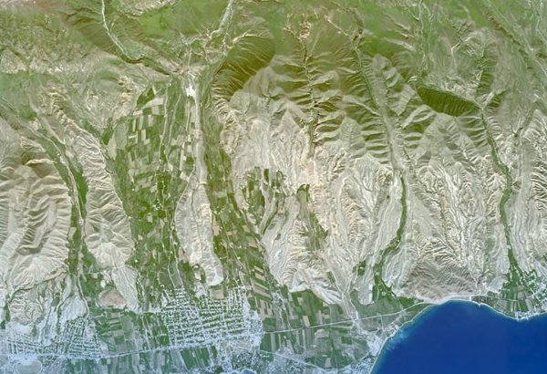
BAKU, Azerbaijan, May 6. Satellite and artificial intelligence (AI) technologies help to identify risk zones in land areas at an early stage, formulate adaptation strategies, and build a more sustainable agricultural model, Chairman of the Board of Directors of the Space Agency of Azerbaijan (Azercosmos), Dunay Badirkhanov, said at a public hearing organized within the framework of the 5th Agribusiness Development Forum, TurkicWorld reports.
He noted that it is possible to see which land is well-cultivated through satellites.
"We have been supporting the decision-making process in the agricultural sector based on satellite data for nine years, and the approach taken during this time has radically changed the logic of agricultural management. Through satellites, we can now see very quickly which areas are planted and which are left empty," Badirkhanov underscored.
He added that, based on data for 2025, the accuracy of strategic crops is in the range of 92-99% compared to satellite-based data, which is also a very high result.
"Satellite data shows us what is happening in the soil today. AI, based on that data, allows us to understand what awaits us tomorrow," the chairman explained.